Browse the archive
15 items matching your filters
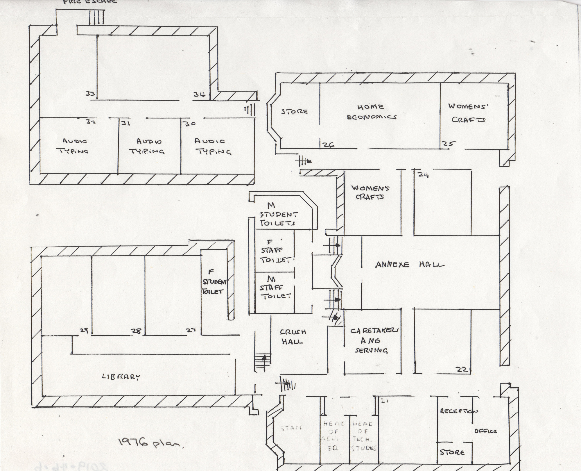
1976 plan of Shipley college - black and white - showing annexe hall, rooms, typing rooms, womens crafts, library etc.
1976 Plan
map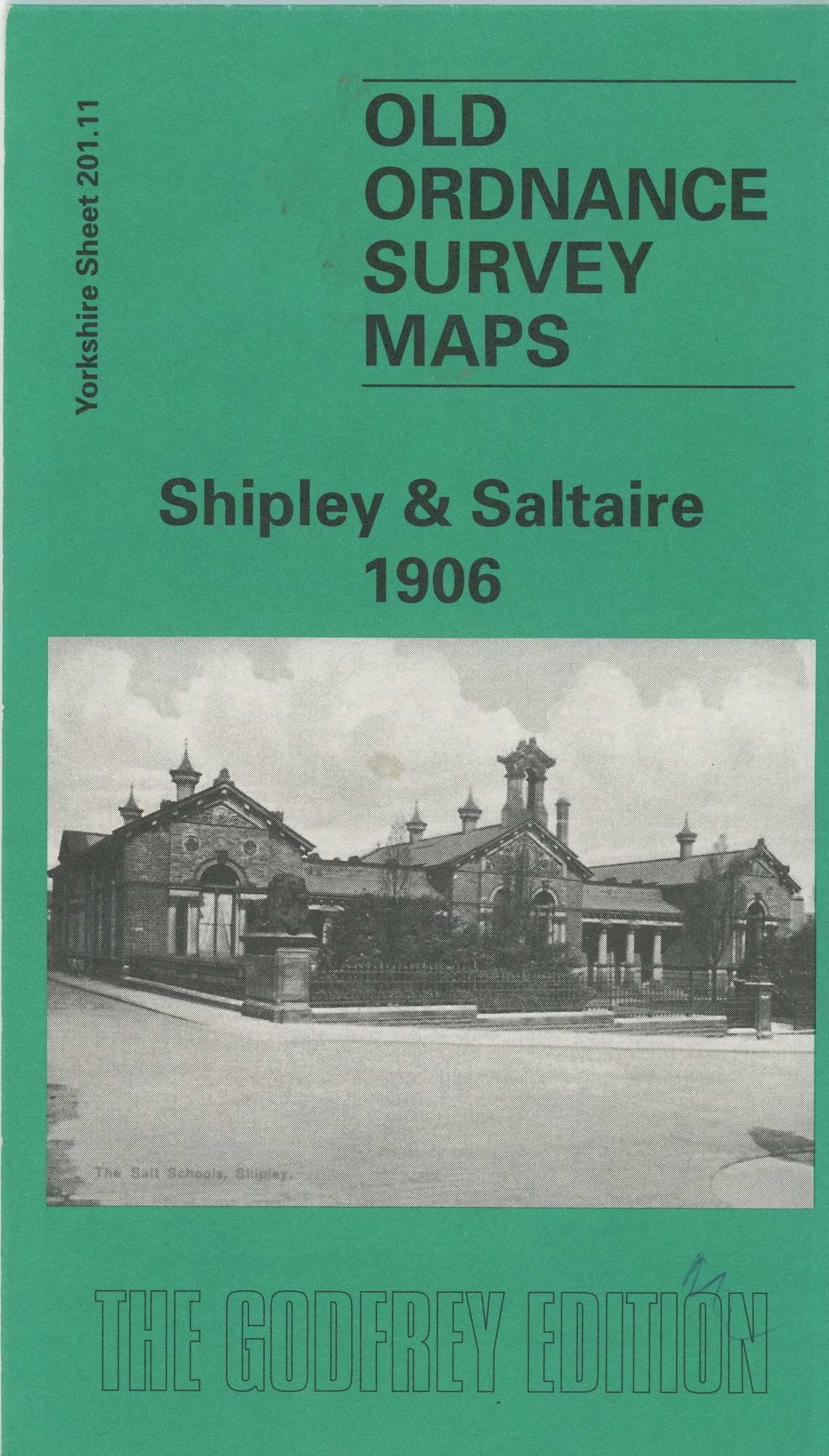
A reproduction of the 1906 Ordnance Survey Map, part of the Godfrey Edition
Old Ordnance Survey Map Shipley & Saltaire 1906
map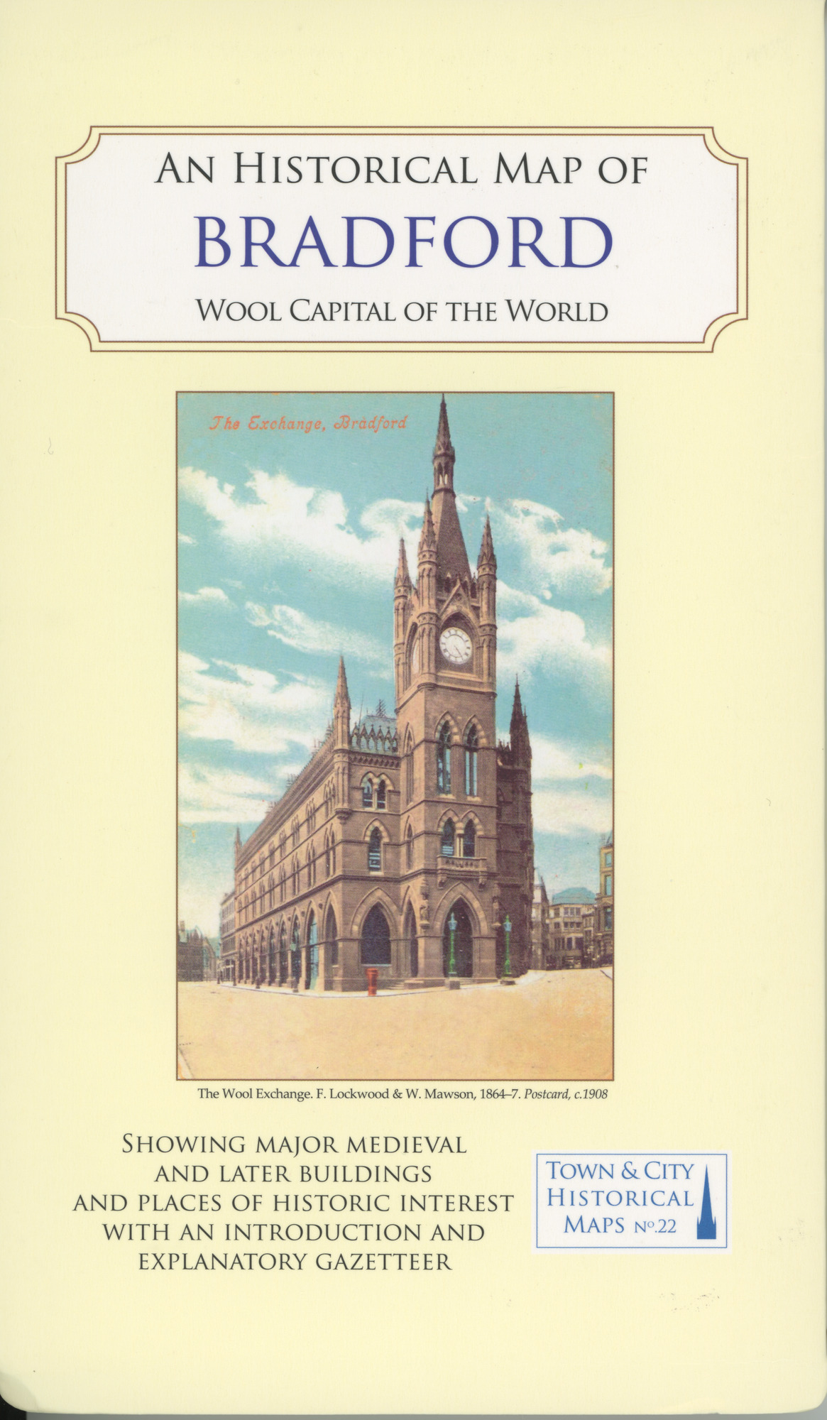
Town & City Historical Maps No.22
Historical Map of Bradford - Wool Capital of the World
map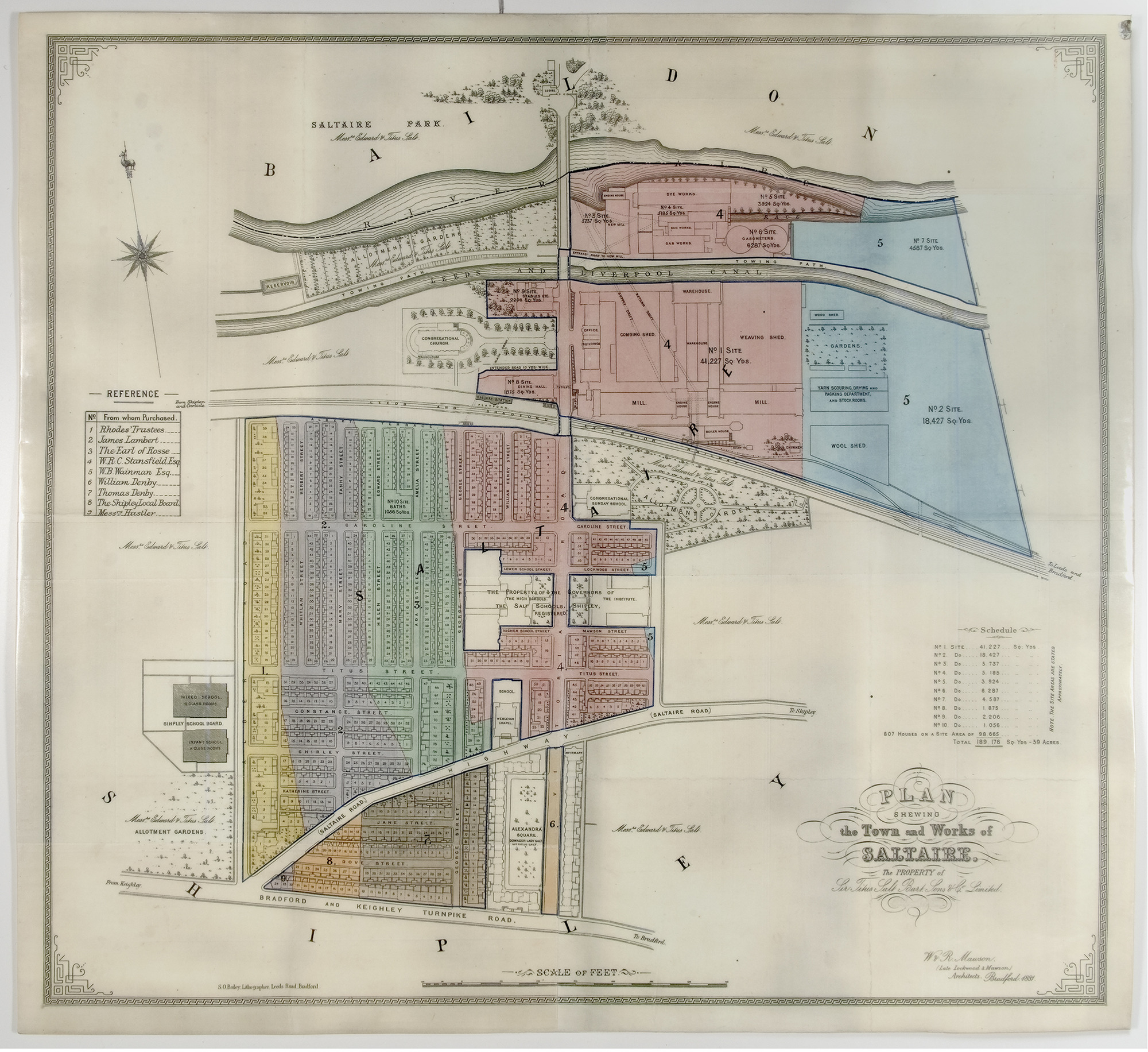
Plan of Salts Mill and Saltaire village
Plan of Salts Mill and village
map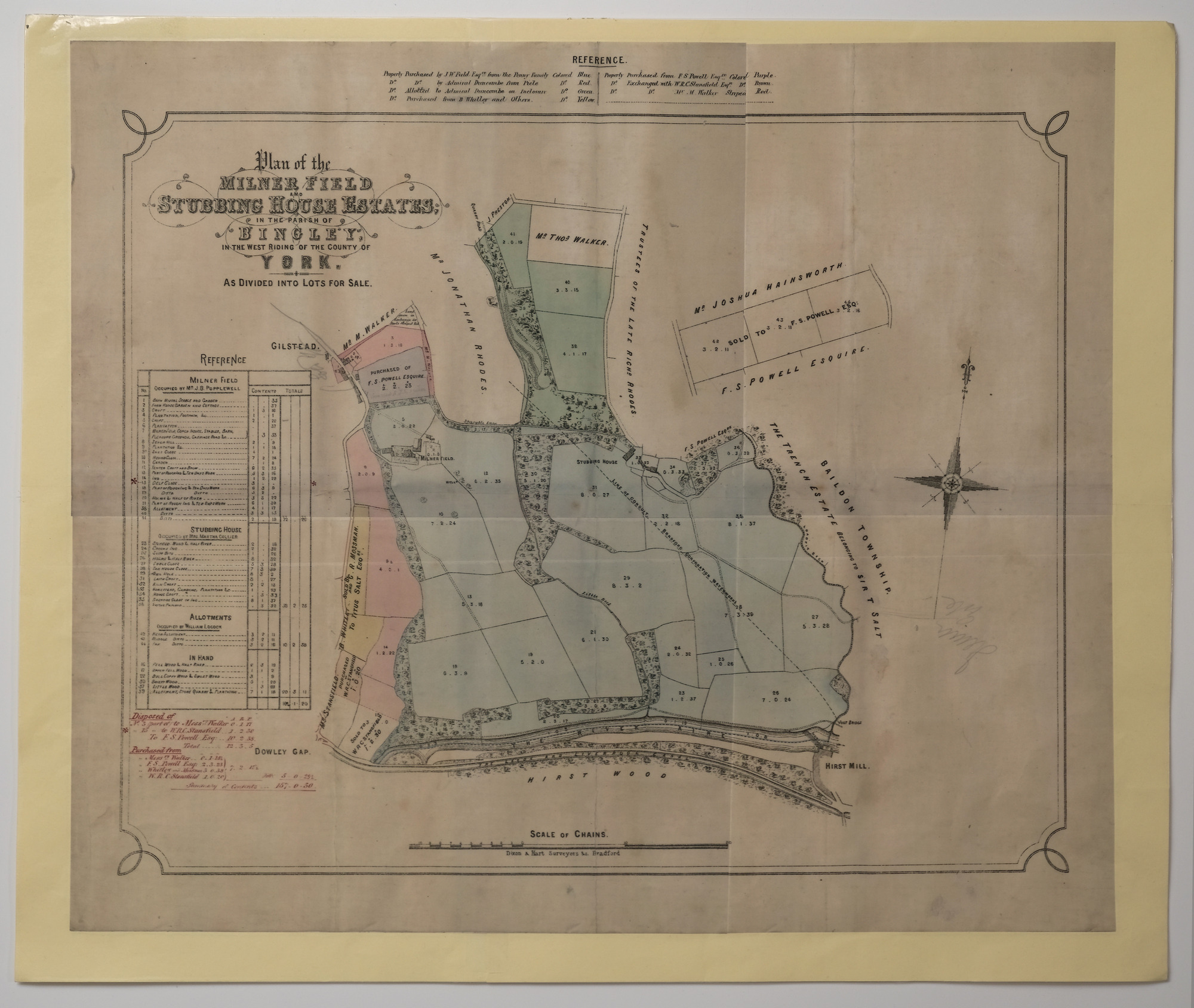
Plan drawn up by Dixon & Hart Surveyors Bradford of the Milner Field and Stubbing House Estates
Map of Milner Field and Stubbing House estates
map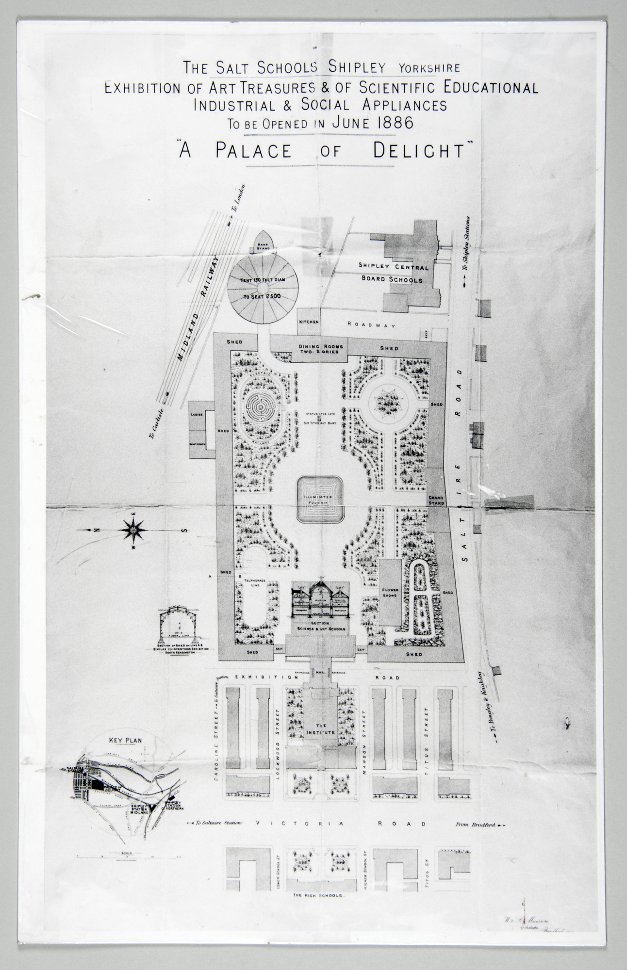
3 Copies of plan of 'A Palace of Delight' The original layout of the 1887 Saltaire Exhibition
A Palace of Delight
map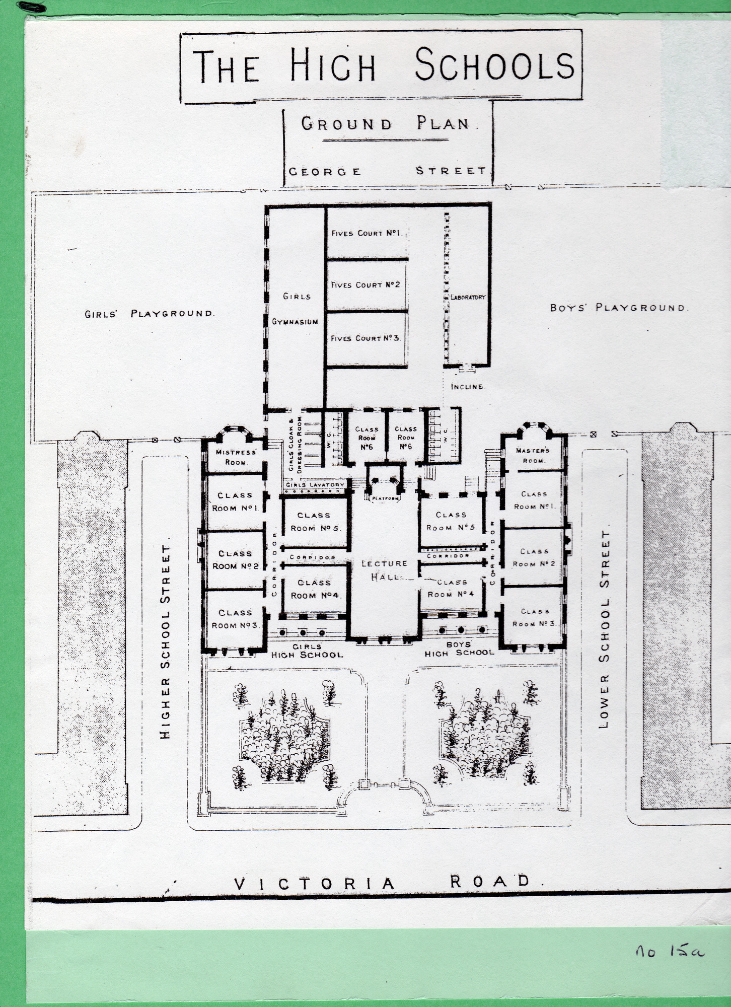
Line-drawn plan of the Salt High School building on Victoria Road
Plan of the High School building on Victoria Road, Saltaire
map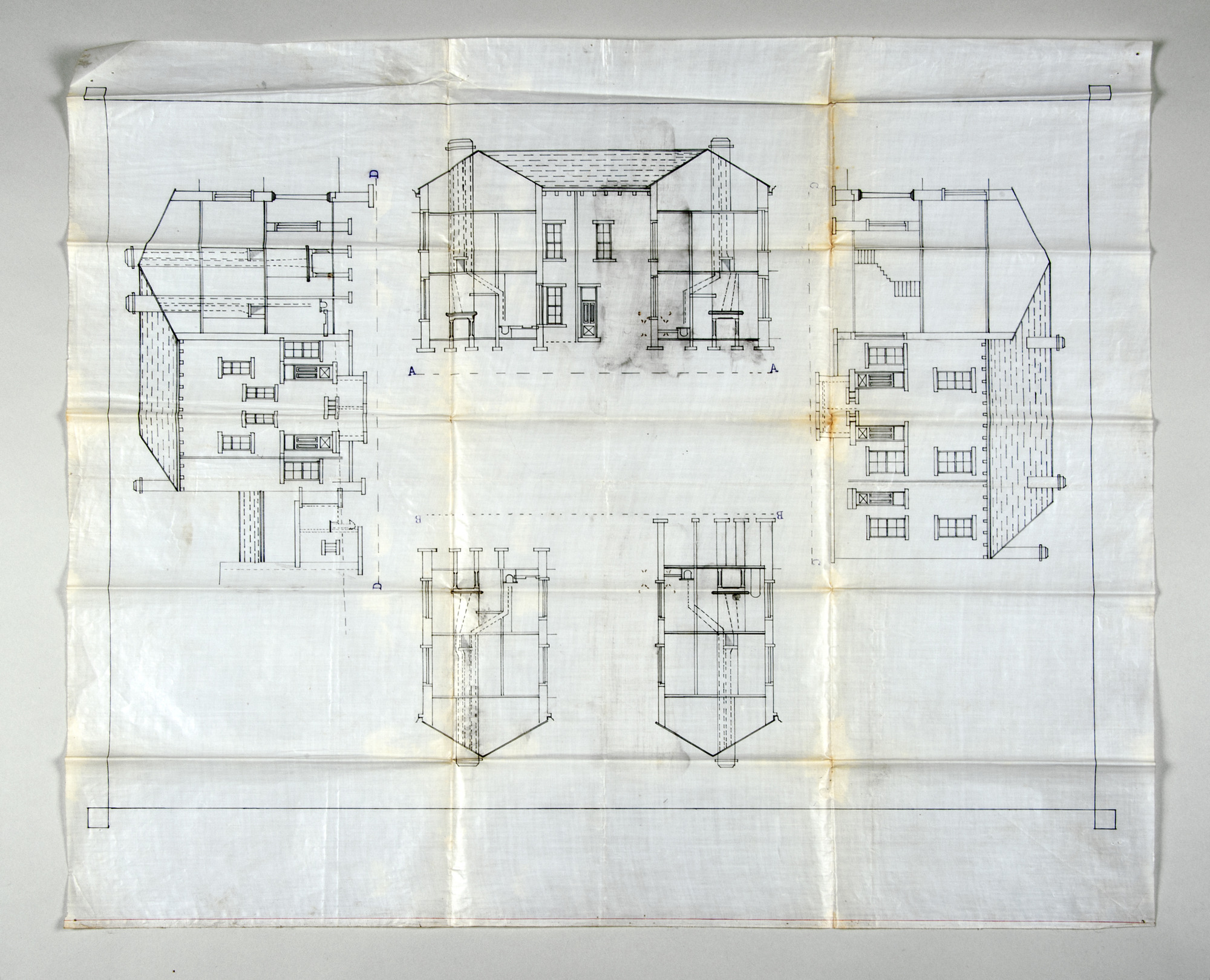
Large scale architect's drawing to show the plans for the conversion of the Wash-house into ten dwelling houses
Wash-house conversion plans - exterior views
map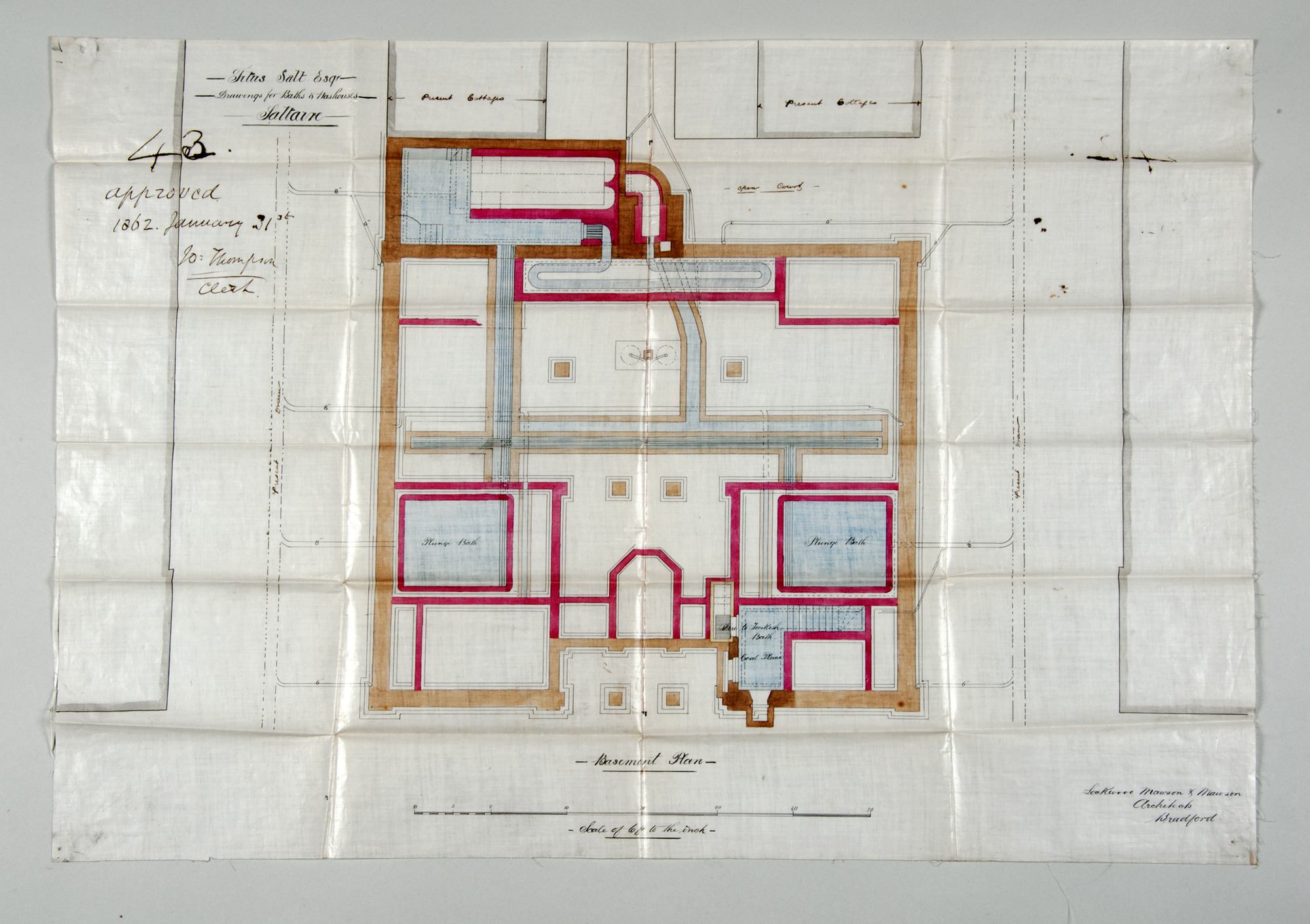
Original Architects drawings for the Bath and Wash house, which was located on Caroline Street
Drawings for the Bath and Wash house
map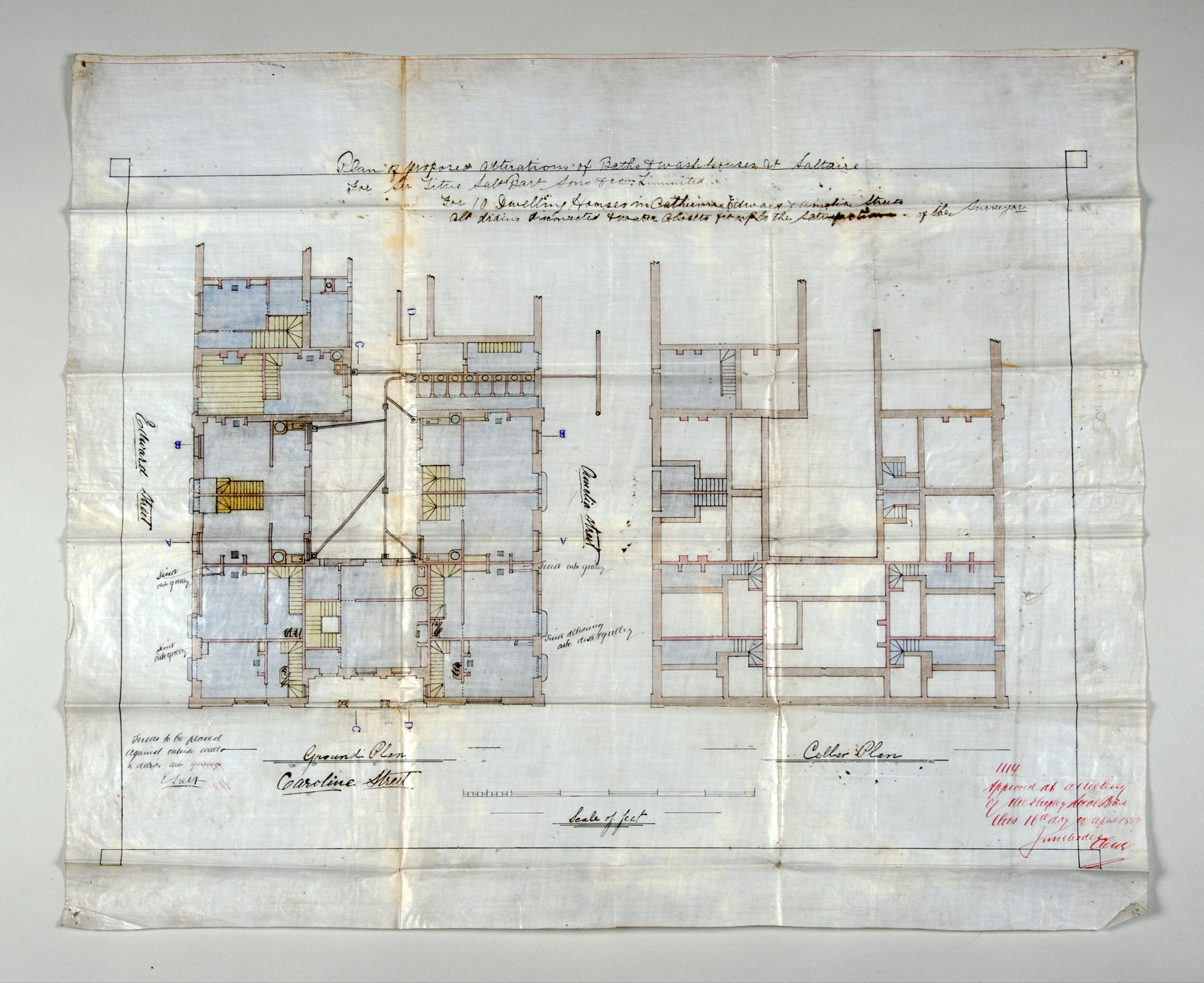
Large scale architect's drawing to show the plans for the conversion of the Wash-house on Caroline Street, Saltaire into houses.
Wash-house conversion plans - ground floor and cellar
map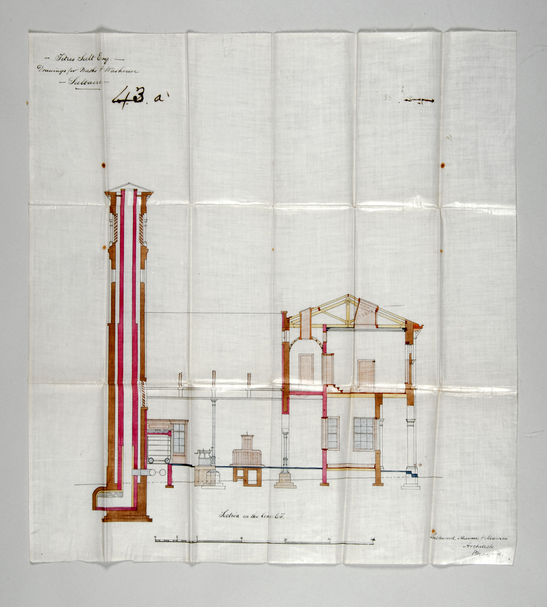
Original architects drawings for the Bath and Wash house, which was located on Caroline Street
Drawings for the Bath and Wash house
map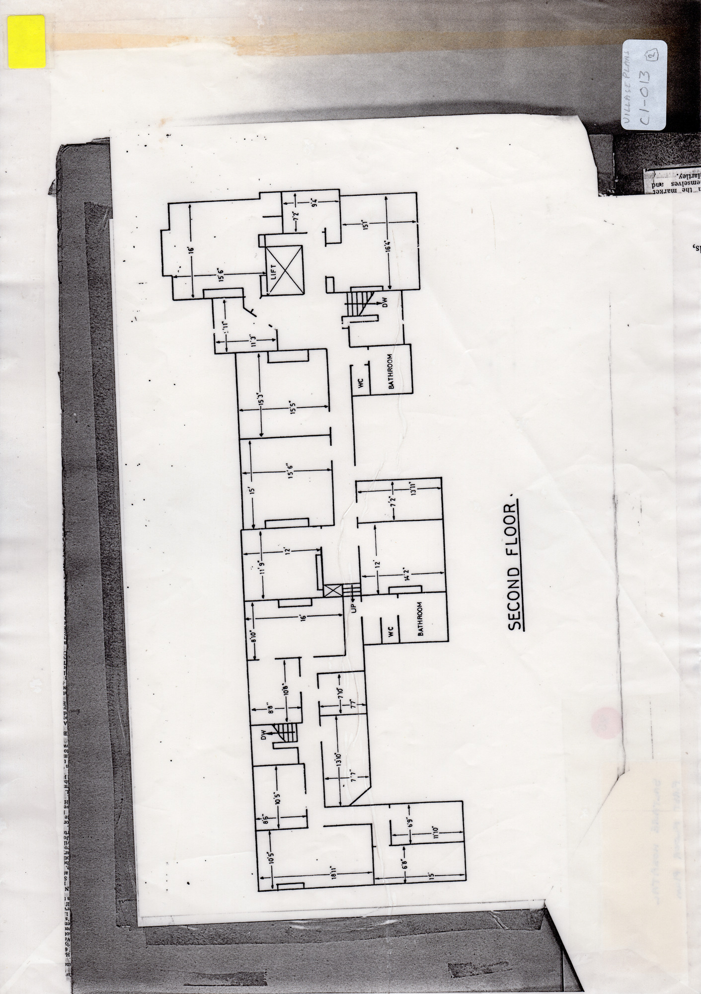
Copy of second floor layout of Saltaire Hospital (1989 Sales plan)
Saltaire village - Maps & Plans
map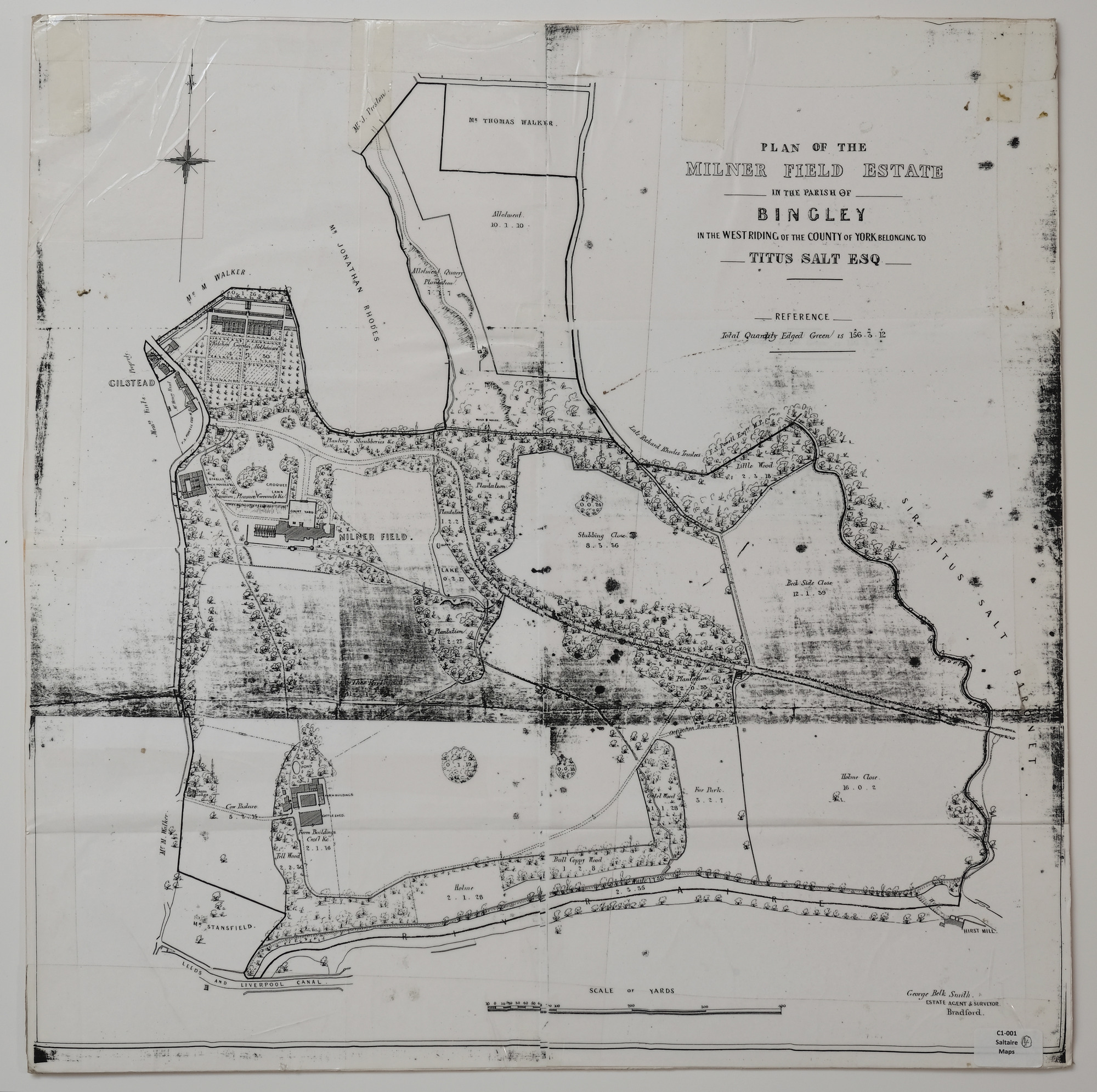
Grey-scale copy of a plan of Milner Field estate in about 1872
Plan of the Milner Field estate
map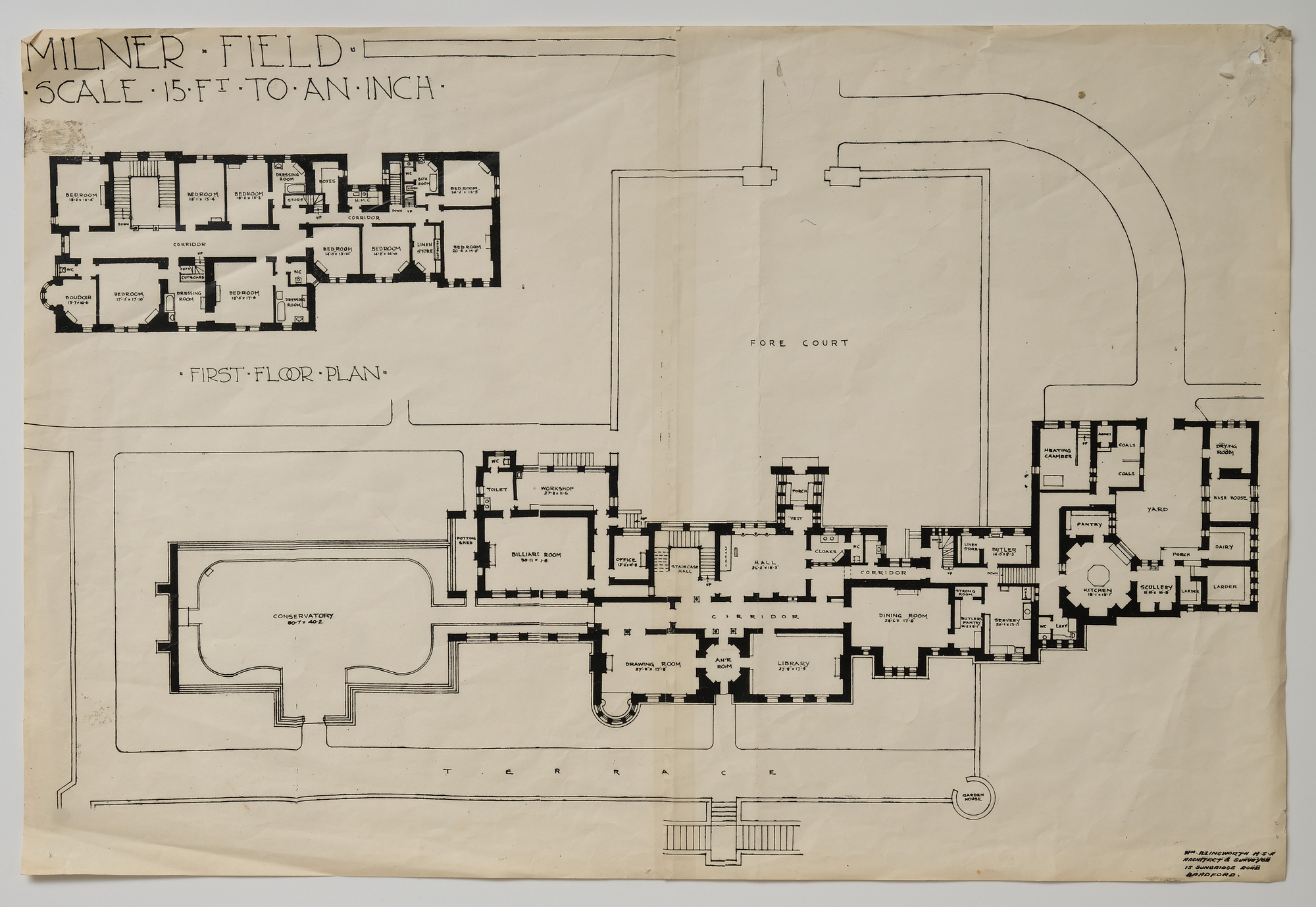
A plan of Milner Field House (the mariied home of TItus Salt Junior and Catherine Salt) by William
Plan of Milner Field House
map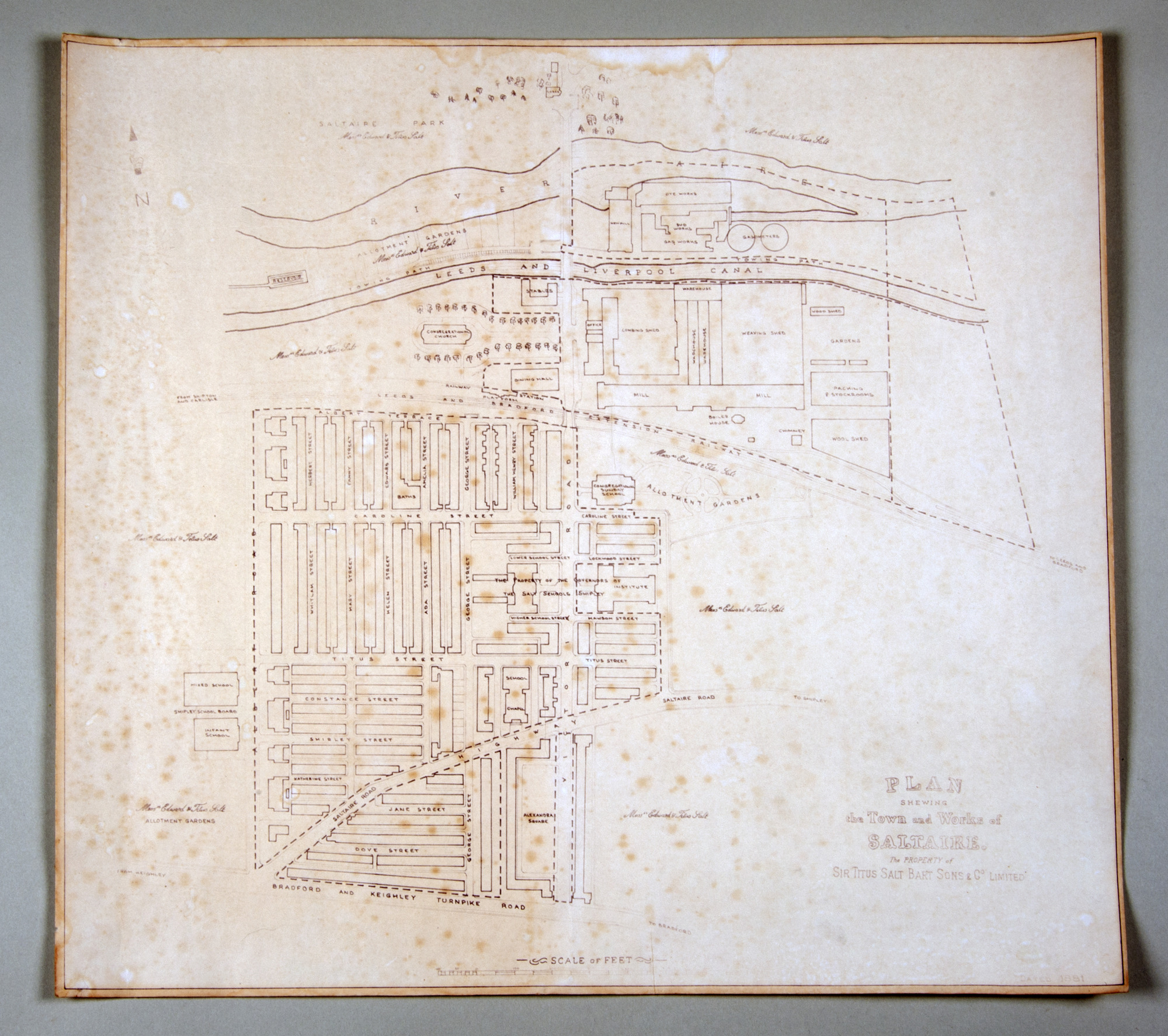
Hand-drawn copy of a plan of Saltaire village and mill, based on late 19th century drawing